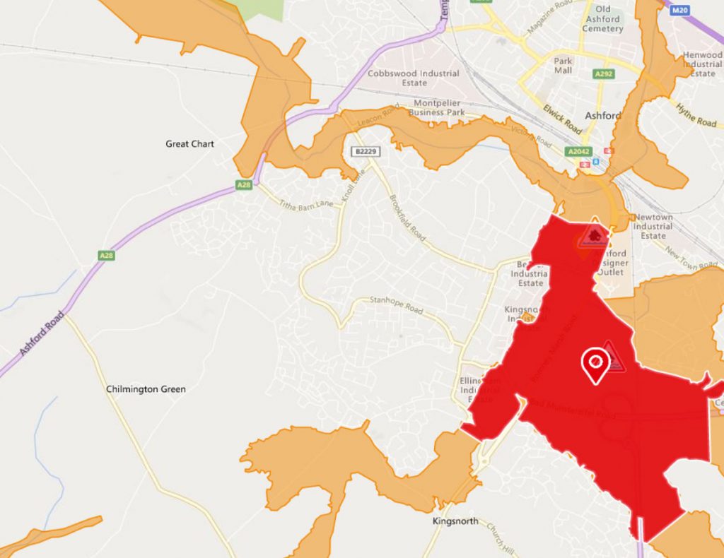
South Ashford on the East Stour River, Aylesford Stream, Whytewater Dyke and Ruckinge Dyke
Flooding is expected – immediate action required

River levels remain high in Ashford following rainfall over the last few days. We expect river levels to fall through Sunday 22 and Monday 23 December. No further heavy or prolonged rainfall is forecast, and we expect the situation to improve. We will update this message by 9am on Monday 23 December, or as the situation changes.
This information was last updated at 9:54pm Sunday 22 December 2019
River levels remain high in Ashford following rainfall over the last few days. We expect river levels to fall through Sunday 22 December. No further heavy or prolonged rainfall is forecast, and we expect the situation to improve. We will update this message by 3pm on Sunday 22 December, or as the situation changes.
This information was last updated at 5:06am Sunday 22 December 2019
Heavy showers have held river levels high and they remain at their peak level. This warning remains in force. We are continuing to monitor conditions in the catchment and are clearing blockages where they are identified. We are storing water at Aldington and Hothfield upstream of Ashford . Residents are recommended to remain vigilant. A few heavy showers are forecast throughout the day before a band of frontal rain passes through overnight from saturday to sunday 21st to 22nd December 2019. River levels will respond to this but given the forecast it is not thought that conditions will be any worse than they were on Friday
This information was last updated at 1:14pm Saturday 21 December 2019
River levels remain high but steady following prolonged rainfall, especially in Ashford. Flooding of properties, including The Stour centre, roads and farmland is possible. We believe there is a possibility of flooding for properties along Tannery Lane. Further rainfall is forecast through Saturday 21 December which may cause levels to rise again. We are closely monitoring the situation. Please plan driving routes to avoid low-lying roads near rivers, which may be flooded. This message will be updated on Saturday afternoon 21/12/2019
This information was last updated at 5:05am Saturday 21 December 2019
https://flood-warning-information.service.gov.uk/target-area/064FWF6SouthAsh
Know what to do
The best way to protect yourself from flooding is to know what to do in advance.
We issue 3 levels of flood warning:

Flood alert – Prepare
- prepare a bag that includes medicines and insurance documents
- check flood warnings

Flood warning – Act
- turn off gas, water and electricity
- move things upstairs or to safety
- move family, pets and car to safety

Severe flood warning – Survive
- call 999 if in immediate danger
- follow advice from emergency services
- keep yourself and your family safe
https://flood-warning-information.service.gov.uk/plan-ahead-for-flooding

